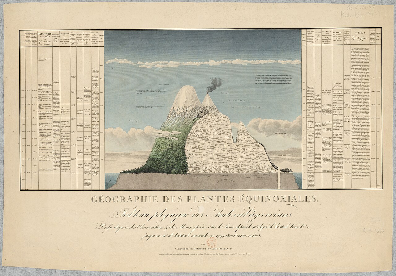

The Earth has nine major natural environments. Or fourteen. Or seventeen. Or thirty.
None of these figures is wrong: each classification sets its own thresholds. It is the question that is badly framed — and this page finally names a problem that has come up some twenty times on this site.
Ecosystem and biome
An ecosystem is a set of living things and the environment in which they live, considered together because they depend on one another. A pond, a hedgerow, a forest, a coral reef: size plays no part in the definition. Only the links count.
These links run mainly through food. In every ecosystem, three roles divide up the work. The producers — plants, algae — make matter from light and minerals. The consumers eat: first the herbivores, then the carnivores that eat the herbivores. The decomposers — bacteria, fungi, worms — break down everything that dies and return the minerals to the soil, where the producers take them up again.1
Without decomposers, the cycle stops within a few years. It is the least visible role and the most indispensable, and it is almost never shown in textbook food chains, which stop at the predator.
A biome belongs to another scale. It is a major type of environment that recurs across the planet wherever conditions are similar — the same climate, the same form of vegetation, the same general architecture of living things. The tropical rainforests of the Amazon, the Congo Basin and Borneo shelter entirely different species, but they form the same biome: the same rains, the same heat, the same layering beneath a canopy.
The major terrestrial biomes recur in every classification, sometimes under different names: tropical forests, temperate forests, boreal forests — the taiga — grasslands and savannahs, hot and cold deserts, tundra, mountains. To these are added aquatic environments: oceans, reefs, wetlands, fresh water.
What decides the biome is almost always the pairing of temperature and precipitation. The same latitude can support a forest or a desert depending on the rain it receives.2
This is not a figure of speech: it is a tool that ecologists actually use. The American Robert Whittaker plotted mean temperature on the horizontal axis and precipitation on the vertical axis, then entered places from all over the world — and the biomes grouped themselves into distinct zones. With these two figures, one can predict what a place one has never seen looks like.3
This is where the problem this page deals with begins. These categories are convenient, but they are not given by nature: someone decided where the boundary runs between a grassland and a savannah, between a savannah and a desert. Depending on where one draws the line, one counts nine biomes, or thirty.
What comes up everywhere
Just look back at questions raised elsewhere on this site:
- How many languages are there in the world? About 7,170 or 7,674, depending on the catalogue — a gap of five hundred, because the boundary between “two languages” and “two ways of speaking the same one” is not drawn in the same place.
- How many people live in cities? 48%, 54% or 76%, depending on the rule applied to define a city.
- How many species are there on Earth? From fewer than two million to several billion.
- How many states of matter are there? Three, four, five or more.
- How many planets are there? Eight since 2006, nine before.
- How many biomes are there? Exactly the same problem.
This is not because scientists lack rigour or change their minds for no reason. The cause runs deeper:
To count, one must first decide what one is counting. That decision is never given by nature: someone makes it.
Faced with a figure, the right question is not only is it accurate?, but: what exactly does it count?
Boundaries are zones
Between a forest and a grassland, there is no line drawn on the ground. There is a gradient: trees ever more widely spaced, grass dotted with a few trunks, then grass alone. This transition zone is called an ecotone.4
Where does the boundary run? Where someone chose to set it.
Transition zones are not anomalies: they are environments in their own right. They are often very rich mosaics where the species of the two environments they separate meet.
The boxes have blurred edges, and that blurriness lies in the nature of things, not in our laziness.
How many biomes? Nine, fourteen, seventeen or thirty
A biome is a large ecological unit defined by its climate and its vegetation: tropical forest, desert, tundra, grassland.
How many are there? It all depends on the classification system:
- 9 in the classical classifications based on climate and vegetation.
- 14 in the system most widely used today for conservation (WWF).
- 17 in the divisions derived from satellite observation.
- For coasts and shallow seas, a separate division distinguishes 12 major marine realms.5
None of these figures is wrong: they simply divide up the world with different rules.
The example of the most widely used system
This classification, published in 2001, nests three levels: 8 major biogeographic realms, 14 biomes, and 867 ecoregions — an ecoregion measuring on average 150,000 square kilometres. It required the collaboration of more than a thousand biologists and ecologists.6
Here is what it changes, in one figure. Earlier divisions counted around 190 to 200 units. This one counts 867: four times more detail.7
But the most instructive thing is to look at where this detail was gained. It is in the tropical regions that the gap is greatest: where the old systems distinguished around 115 units, the new one distinguishes 463.8
In other words, the earlier maps were coarsest where life is most diverse. This was no accident: one divides finely what one knows well, and the temperate regions were better known.
A map does not show only the world. It also shows where people have looked.
Note, too, that the number itself has shifted since: the map revised in 2017 counts 846 ecoregions, against 867 in 2001. This is not carelessness; it reflects updated data and redrawn boundaries.9
How ambiguous cases are settled
To classify an uncertain place, it is positioned on a graph according to its temperatures and its precipitation. If it straddles several biomes, the method is to widen the scale gradually until one unit becomes dominant.
One does not discover the intrinsic “truth” of a place: one looks for the model it most resembles. A biome map is a reading tool, not a fixed portrait.
A natural environment is never empty
One last stubborn misconception: that the great natural environments are untouched expanses, free of any human presence.
- Savannahs and grasslands have often been maintained by controlled fire: in Australia, for example, burning in small patches makes hunting more productive.
- Wetlands have been shaped or drained according to political and economic choices.
- Polar and arid regions have been inhabited for a very long time by societies that have adapted to them.10
An environment described without its human inhabitants is an incomplete environment: it lacks one of the major factors that shaped it.
A way of reading
This page does not describe each biome in detail — they are explored in the entries devoted to forests, deserts, mountains and oceans. It provides the framework for approaching them.
Faced with the description of a natural environment, two questions are always useful:
- Who drew this boundary, and by what criterion?
- Who lives there, and since when?
Note 1
Decomposers turn organic wastes, such as decaying plants, into inorganic materials, such as nutrient-rich soil. They complete the cycle of life, returning nutrients to the soil or oceans for use by autotrophs.
National Geographic Society, “Food Web”, ressource éducative, open access
Note 2
The eight major terrestrial biomes on Earth are each distinguished by characteristic temperatures and amount of precipitation.
Clark, Mary Ann, Douglas, Matthew and Choi, Jung, Biology 2e, Houston, OpenStax, 2018, section 44.3 “Terrestrial Biomes”, open access
Note 3
Robert Whittaker, an American ecologist, plotted rainfall vs. temperature for points all over the globe on a single graph (see below). He then looked at what biomes had developed at those sites, and was able to group the different biomes according to mean annual temperature and precipitation, as the shaded areas in the graph below indicate.
Marietta College, Department of Biology and Environmental Science, “Biomes of the World”, main page (“Main Biomes Page”)
Note 4
ecotone, a transitional area of vegetation between two different plant communities, such as forest and grassland.
Encyclopaedia Britannica, “ecotone”, article revised by John P. Rafferty, online
Note 5
This is a map of an ecological classification of the world's climates. […] There are nine different major zonobiomes, which have modifiers added if they are particularly dry, cold or wet.
FAO, FRA 2000: A Concept and Strategy for Ecological Zoning for the Global Forest Resources Assessment 2000, FRA Working Paper 20, Rome
Here we report on a new global system for coastal and shelf areas: the Marine Ecoregions of the World, or MEOW, a nested system of 12 realms, 62 provinces, and 232 ecoregions.
Spalding, Mark D. et al., “Marine Ecoregions of the World: A Bioregionalization of Coastal and Shelf Areas”, BioScience, vol. 57, no. 7, 2007, p. 573-583
Note 6
We subdivided the terrestrial world into 14 biomes and eight biogeographic realms (Figure 1). Nested within these are 867 ecoregions (Figure 2).
Olson, David M. et al., “Terrestrial Ecoregions of the World: A New Map of Life on Earth”, BioScience, vol. 51, no. 11, 2001, p. 933-938
The average size of our ecoregions is roughly 150,000 km² (median 56,300 km²)
Olson, David M. et al., “Terrestrial Ecoregions of the World: A New Map of Life on Earth”, BioScience, vol. 51, no. 11, 2001, p. 933-938
they are built on the foundations of classical biogeography and reflect extensive collaboration with over 1000 biogeographers, taxonomists, conservation biologists, and ecologists from around the world.
Olson, David M. et al., “Terrestrial Ecoregions of the World: A New Map of Life on Earth”, BioScience, vol. 51, no. 11, 2001, p. 933-938
We subdivided the terrestrial world into 14 biomes and eight biogeographic realms (Figure 1). Nested within these are 867 ecoregions (Figure 2).
Olson, David M. et al., “Terrestrial Ecoregions of the World: A New Map of Life on Earth”, BioScience, vol. 51, no. 11, 2001, p. 933-938, open access
Note 7
This is roughly a fourfold increase in resolution over that of the 198 biotic provinces of Dasmann (1974) and the 193 units of Udvardy (1975).
Olson, David M. et al., “Terrestrial Ecoregions of the World: A New Map of Life on Earth”, BioScience, vol. 51, no. 11, 2001, p. 933-938
Note 8
The increased resolution is most apparent in the tropics […] where Dasmann (1974) and Udvardy (1975) identify 115 and 117 units, respectively, compared with 463 found in the ecoregion map.
Olson, David M. et al., “Terrestrial Ecoregions of the World: A New Map of Life on Earth”, BioScience, vol. 51, no. 11, 2001, p. 933-938
Note 9
To address these questions and enhance systematic planning for terrestrial biodiversity conservation, we revised the 2001 map of terrestrial ecoregions of the world (supplemental appendix S1; Olson et al. 2001). […] We conducted this analysis across all 846 terrestrial ecoregions distributed among the Earth's 14 terrestrial biomes (supplemental appendix S1).
Dinerstein, Eric et al., “An Ecoregion-Based Approach to Protecting Half the Terrestrial Realm”, BioScience, vol. 67, no. 6, 2017, p. 534-545
Note 10
We combine ethnographic observations of contemporary Aboriginal hunting and burning with satellite image analysis of anthropogenic and natural landscape structure to demonstrate the processes through which Aboriginal burning shapes arid-zone vegetational diversity. […] The maintenance of small-scale habitat mosaics increases small-animal hunting productivity.
Bliege Bird, Rebecca et al., “The "Fire Stick Farming" Hypothesis”, Proceedings of the National Academy of Sciences, vol. 105, 2008, p. 14796-14801
Notes and sources
- ↑
Passage The producers […] The consumers […] The decomposers […] return the minerals to the soil
Decomposers turn organic wastes, such as decaying plants, into inorganic materials, such as nutrient-rich soil. They complete the cycle of life, returning nutrients to the soil or oceans for use by autotrophs.
Source National Geographic Society, “Food Web”, ressource éducative, open access, section on decomposers.
Open access open the source · checked on 24 October 2026
- ↑
Passage What decides the biome is almost always the pairing of temperature and precipitation.
The eight major terrestrial biomes on Earth are each distinguished by characteristic temperatures and amount of precipitation.
Source Clark, Mary Ann, Douglas, Matthew and Choi, Jung, Biology 2e, Houston, OpenStax, 2018, section 44.3 “Terrestrial Biomes”, open access, section 44.3 “Terrestrial Biomes”, introductory paragraph.
Open access open the source · checked on 24 October 2026
- ↑
Passage Robert Whittaker plotted mean temperature on the horizontal axis and precipitation on the vertical axis […] and the biomes grouped themselves into distinct zones
Robert Whittaker, an American ecologist, plotted rainfall vs. temperature for points all over the globe on a single graph (see below). He then looked at what biomes had developed at those sites, and was able to group the different biomes according to mean annual temperature and precipitation, as the shaded areas in the graph below indicate.
Source Marietta College, Department of Biology and Environmental Science, “Biomes of the World”, main page (“Main Biomes Page”), main page of the “Biomes of the World” site, paragraph on Whittaker’s diagram.
Open access open the source · checked on 27 October 2026
- ↑
Passage This transition zone is called an ecotone.
ecotone, a transitional area of vegetation between two different plant communities, such as forest and grassland.
Source Encyclopaedia Britannica, “ecotone”, article revised by John P. Rafferty, online, definition (1st sentence of the article).
Open access open the source · checked on 27 October 2026
- ↑
Passage 9 in the classical classifications based on climate and vegetation
This is a map of an ecological classification of the world's climates. […] There are nine different major zonobiomes, which have modifiers added if they are particularly dry, cold or wet.
Source FAO, FRA 2000: A Concept and Strategy for Ecological Zoning for the Global Forest Resources Assessment 2000, FRA Working Paper 20, Rome, Annex B, section “Map of Walter’s Zonobiomes”, descriptive paragraph.
Open access open the source · checked on 27 October 2026
Passage For coasts and shallow seas, a separate division distinguishes 12 major marine realms.
Here we report on a new global system for coastal and shelf areas: the Marine Ecoregions of the World, or MEOW, a nested system of 12 realms, 62 provinces, and 232 ecoregions.
Source Spalding, Mark D. et al., “Marine Ecoregions of the World: A Bioregionalization of Coastal and Shelf Areas”, BioScience, vol. 57, no. 7, 2007, p. 573-583, abstract.
Open access · checked on 24 October 2026
- ↑
Passage 8 major biogeographic realms, 14 biomes, and 867 ecoregions
We subdivided the terrestrial world into 14 biomes and eight biogeographic realms (Figure 1). Nested within these are 867 ecoregions (Figure 2).
Source Olson, David M. et al., “Terrestrial Ecoregions of the World: A New Map of Life on Earth”, BioScience, vol. 51, no. 11, 2001, p. 933-938, p. 934.
Open access open the source · checked on 9 September 2026
Passage an ecoregion measuring on average 150,000 square kilometres
The average size of our ecoregions is roughly 150,000 km² (median 56,300 km²)
Source Olson, David M. et al., “Terrestrial Ecoregions of the World: A New Map of Life on Earth”, BioScience, vol. 51, no. 11, 2001, p. 933-938, p. 934.
Open access open the source · checked on 9 September 2026
Passage It required the collaboration of more than a thousand biologists and ecologists.
they are built on the foundations of classical biogeography and reflect extensive collaboration with over 1000 biogeographers, taxonomists, conservation biologists, and ecologists from around the world.
Source Olson, David M. et al., “Terrestrial Ecoregions of the World: A New Map of Life on Earth”, BioScience, vol. 51, no. 11, 2001, p. 933-938.
Open access open the source · checked on 9 September 2026
Passage This classification, published in 2001, nests three levels
We subdivided the terrestrial world into 14 biomes and eight biogeographic realms (Figure 1). Nested within these are 867 ecoregions (Figure 2).
Source Olson, David M. et al., “Terrestrial Ecoregions of the World: A New Map of Life on Earth”, BioScience, vol. 51, no. 11, 2001, p. 933-938, open access, p. 934, body of the article (BioScience, November 2001, vol. 51 n° 11).
Open access open the source · checked on 24 October 2026
- ↑
Passage Earlier divisions counted around 190 to 200 units. This one counts 867: four times more detail.
This is roughly a fourfold increase in resolution over that of the 198 biotic provinces of Dasmann (1974) and the 193 units of Udvardy (1975).
Source Olson, David M. et al., “Terrestrial Ecoregions of the World: A New Map of Life on Earth”, BioScience, vol. 51, no. 11, 2001, p. 933-938, body of the article.
Open access open the source · checked on 9 September 2026
- ↑
Passage It is in the tropical regions that the gap is greatest: where the old systems distinguished around 115 units, the new one distinguishes 463.
The increased resolution is most apparent in the tropics […] where Dasmann (1974) and Udvardy (1975) identify 115 and 117 units, respectively, compared with 463 found in the ecoregion map.
Source Olson, David M. et al., “Terrestrial Ecoregions of the World: A New Map of Life on Earth”, BioScience, vol. 51, no. 11, 2001, p. 933-938, body of the article.
Open access open the source · checked on 9 September 2026
- ↑
Passage the number itself has shifted since: the map revised in 2017 counts 846 ecoregions
To address these questions and enhance systematic planning for terrestrial biodiversity conservation, we revised the 2001 map of terrestrial ecoregions of the world (supplemental appendix S1; Olson et al. 2001). […] We conducted this analysis across all 846 terrestrial ecoregions distributed among the Earth's 14 terrestrial biomes (supplemental appendix S1).
Source Dinerstein, Eric et al., “An Ecoregion-Based Approach to Protecting Half the Terrestrial Realm”, BioScience, vol. 67, no. 6, 2017, p. 534-545, introduction (before the section “Evaluating protected area networks using ecoregions”).
Open access · checked on 24 October 2026
- ↑
Passage Savannahs and grasslands have often been maintained by controlled fire: in Australia, for example, burning in small patches makes hunting more productive.
We combine ethnographic observations of contemporary Aboriginal hunting and burning with satellite image analysis of anthropogenic and natural landscape structure to demonstrate the processes through which Aboriginal burning shapes arid-zone vegetational diversity. […] The maintenance of small-scale habitat mosaics increases small-animal hunting productivity.
Source Bliege Bird, Rebecca et al., “The "Fire Stick Farming" Hypothesis”, Proceedings of the National Academy of Sciences, vol. 105, 2008, p. 14796-14801, abstract.
Open access · checked on 24 October 2026
Bibliography
11
- Bliege Bird, Rebecca et al., “The "Fire Stick Farming" Hypothesis”, Proceedings of the National Academy of Sciences, vol. 105, 2008, p. 14796-14801, open access (the maintenance of savannahs by fire; see Entry 2.9).
- Clark, Mary Ann, Douglas, Matthew and Choi, Jung, Biology 2e, Houston, OpenStax, 2018, section 44.3 “Terrestrial Biomes”, open access (the major terrestrial biomes distinguished by their temperatures and precipitation). https://openstax.org/books/biology-2e/pages/44-3-terrestrial-biomes
- Dinerstein, Eric et al., “An Ecoregion-Based Approach to Protecting Half the Terrestrial Realm”, BioScience, vol. 67, no. 6, 2017, p. 534-545, open access (the revision of the number of terrestrial ecoregions).
- Encyclopaedia Britannica, “ecotone”, article revised by John P. Rafferty, online, open access (the ecotone, a transitional area of vegetation between two plant communities, such as forest and grassland). https://www.britannica.com/science/ecotone
- FAO, FRA 2000: A Concept and Strategy for Ecological Zoning for the Global Forest Resources Assessment 2000, FRA Working Paper 20, Rome, open access (the nine major zonobiomes of Walter’s climatic classification, Annex B). https://www.fao.org/4/ac632e/AC632E00.htm
- Marietta College, Department of Biology and Environmental Science, “Biomes of the World”, main page (“Main Biomes Page”), open access (Robert Whittaker’s graph: precipitation and temperature of places all over the world, and the biomes grouped into zones). https://academic.marietta.edu/departments/biology/biomes/biome_main.htm
- National Geographic Society, “Food Web”, ressource éducative, open access (producers, herbivorous and carnivorous consumers; the decomposers that return nutrients to the soil for the producers). https://education.nationalgeographic.org/resource/food-web/
- Olson, David M. et al., “Terrestrial Ecoregions of the World: A New Map of Life on Earth”, BioScience, vol. 51, no. 11, 2001, p. 933-938, open access (8 biogeographic realms, 14 biomes and 867 ecoregions; an average size of 150,000 km²; the collaboration of more than a thousand specialists; a fourfold increase in resolution compared with the 193 to 198 earlier units, the gain being most marked in the tropics). https://observatoriopantanal.org/wp-content/uploads/crm_perks_uploads/5cb0f734750a11456042675850236/2019/08/2001_Terrestrial_Ecoregions_of_the_World_A_New_Map_of_Life_on_Earth.pdf
- Spalding, Mark D. et al., “Marine Ecoregions of the World: A Bioregionalization of Coastal and Shelf Areas”, BioScience, vol. 57, no. 7, 2007, p. 573-583, open access (marine biomes, bringing the total to around thirty).
- Van der Maarel, Eddy, “Ecotones and Ecoclines Are Different”, Journal of Vegetation Science, vol. 1, 1990, p. 135-138, paywalled (the distinction between an abrupt transition and a continuous gradient).
- Whittaker, Robert H., Communities and Ecosystems, Macmillan, New York, 1975, in libraries (the diagram linking mean temperature, precipitation and biome type).
Spotted an error or have a doubt? Write to us.